See constraints before they cost you
Spot terrain, environmental and utility issues before you pay for diligence.

Research, data and maps for land, energy, infrastructure and logistics.
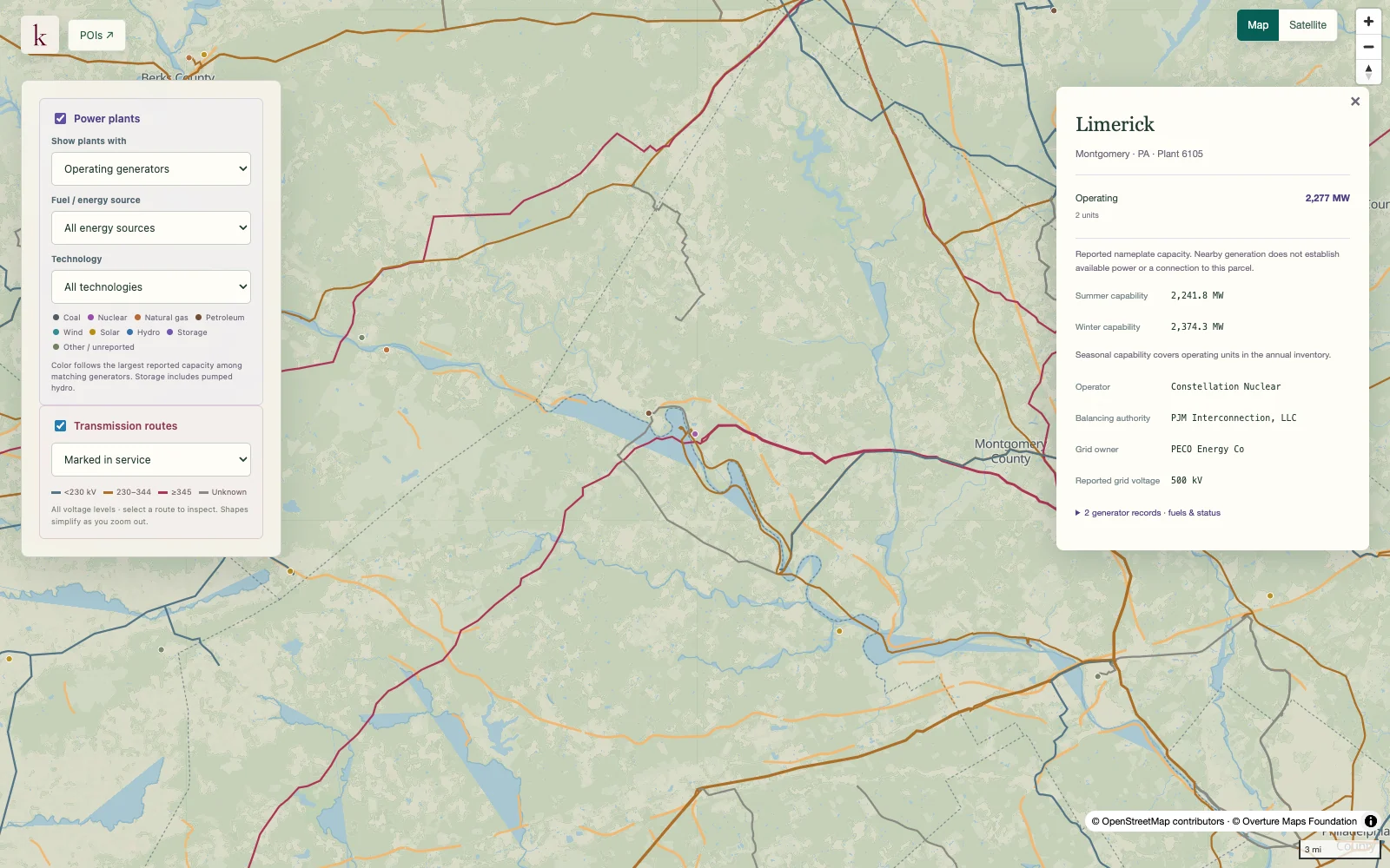
Example question: How much generation sits near Limerick, Pennsylvania?
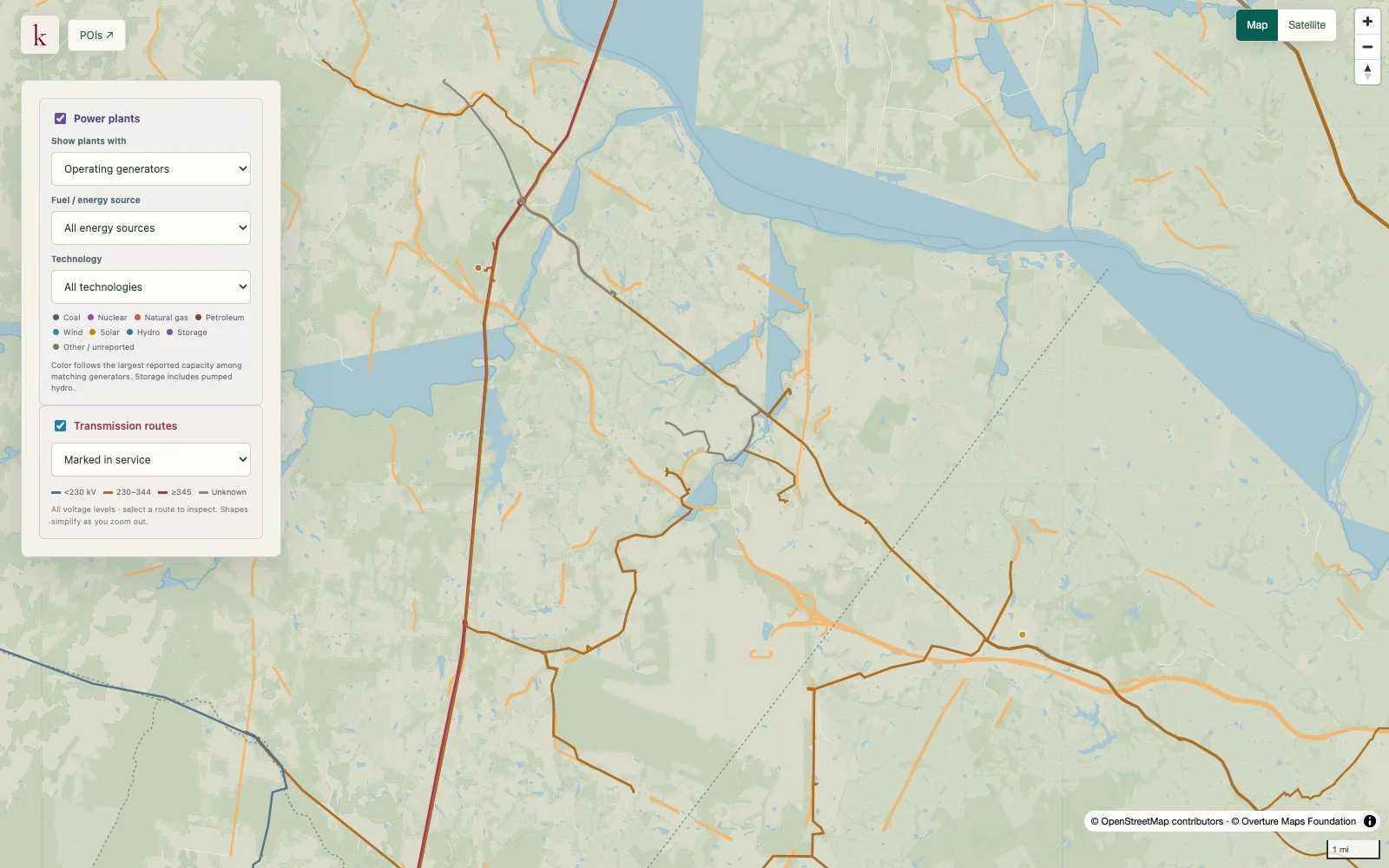
Example question: What power infrastructure surrounds Ashburn, Virginia?
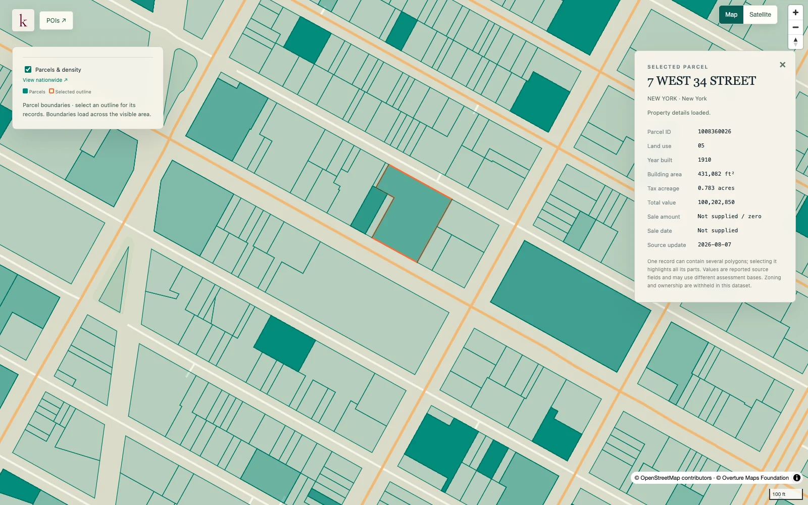
Example question: What’s on record for 7 West 34th Street?
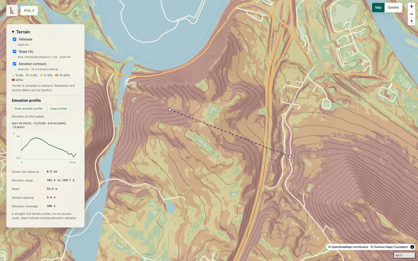
Example question: How steep is the ground across this Berks County site?
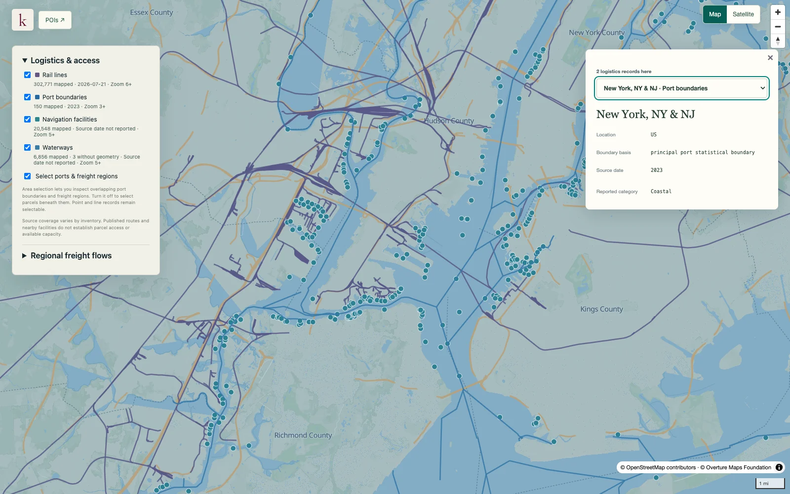
Example question: How do rail and waterways reach the New York harbor?
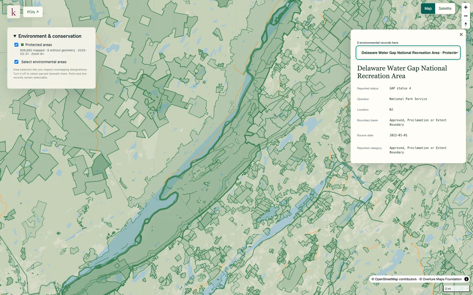
Example question: Which protected areas border the Delaware Water Gap?
Spot terrain, environmental and utility issues before you pay for diligence.
Find the generation, transmission and energy prices around a site, and how they have changed.
Every finding links to dated evidence, so your shortlist stands up to scrutiny.
How does the energy picture change across places and time?
What is on this land, and what needs a closer look?
Which utility systems and connectivity routes are nearby?
How does a place connect to the movement of goods?
What is being built, where, and how far along is it?
What can observations tell us about how a place has changed?
Buy a finished assessment for a state, a region or the whole country, published monthly.
Chat with Korzy and see every answer on the map, or connect it to Claude and ChatGPT with our plugins.
Query the same records from your product, pipeline or agent, and pay only for what you use.
Human-verified research reports on the best sites for development, starting with the Data Center Site Shortlist for every state, region and the whole country.
Explore researchSign up for early access. Tell us what you’re working on and we’ll reach out when Korzy is ready for it.